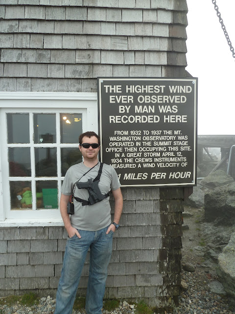
Worst weather in the world. I would hate to experience 231mph winds.
Monument to the lack of preparedness. Bet you are really happy you went 'extra light' and saved some weight huh?
50 MPH Wind
One state park ranger didn't know the law and he had to be educated. He doesn't understand what constitutional carry means. Not sure what part of SHALL NOT BE INFRINGED UPON isn't clear.. Must be an idiot from taxachusets or peoples republic of nj...
I had a bowl of chili at the restaurant on top without any other incidents.
Stations which heard KB3UOO-7 directly on radio –
| callsign | pkts | first heard - UTC | last heard | longest | (tx => rx) | longest at - UTC | |
|---|---|---|---|---|---|---|---|
| VE2RAW-3 | 1 | 2012-06-21 20:01:52 | 2012-06-21 20:01:52 | FN44IG > FN35LL | 120.0 miles 314° | 2012-06-21 20:01:52 | |
| KQ1L-1 | 5 | 2012-06-21 18:46:30 | 2012-06-21 20:42:10 | FN44IG > FN44SF | 43.7 miles 92° | 2012-06-21 19:31:47 | |
| W1PIG | 3 | 2012-06-21 18:56:34 | 2012-06-21 19:26:46 | FN44IG > FN54FI | 86.8 miles 86° | 2012-06-21 19:26:46 | |
| VE2PCQ-3 | 1 | 2012-06-21 20:01:51 | 2012-06-21 20:01:51 | FN44IG > FN35BX | 173.1 miles 314° | 2012-06-21 20:01:51 | |
| N1JOV-9 | 1 | 2012-06-21 19:16:39 | 2012-06-21 19:16:39 | FN44IG > FN53AV | 71.0 miles 110° | 2012-06-21 19:16:39 | |
| W1CNH-5 | 1 | 2012-06-21 19:21:44 | 2012-06-21 19:21:44 | FN44IG > FN43GS | 36.3 miles 192° | 2012-06-21 19:21:44 | |
| KB1FDA-1 | 2 | 2012-06-21 20:26:54 | 2012-06-21 20:31:55 | FN44IG > FN34UB | 49.5 miles 253° | 2012-06-21 20:31:55 |
Thats right! Not an error - I was heard 173.1 miles away with a little 5W radio and a whip antenna. The 6 miles of elevation probably helped a little.
| Location: | 44°16.40' N 71°18.08' W - locator FN44IG35UO - show map - static map 13.5 miles North bearing 356° from Bartlett, Carroll County, New Hampshire, United States [?] 15.9 miles East bearing 79° from Deerfield, Grafton County, New Hampshire, United States 67.0 miles Northwest bearing 309° from Portland, Cumberland County, Maine, United States 72.2 miles North bearing 9° from East Concord, Merrimack County, New Hampshire, United States |
|---|---|
| Last position: | 2012-06-21 20:42:10 UTC (3d 7h21m ago) 2012-06-21 16:42:10 EDT local time at Bartlett, United States [?] |
| Altitude: | 6119 ft |
| Course: | 326° |
| Speed: | 13 MPH |
| Device: | Yaesu: VX-8G (ht) |
| Last path: | KB3UOO-7>TTQV4P via KQ1L-1*,WIDE1*,WIDE2-1,qAR,N1JOV-9  |
Ed's Truck


No comments:
Post a Comment